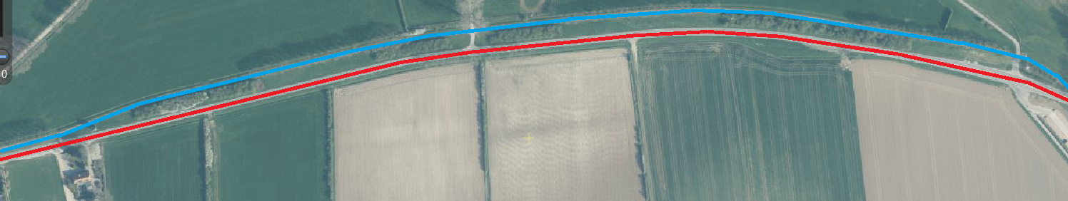
The coding manual recommends using the distance system of the road authority. In the Netherlands the provincial roads have a distance system, which is based on the center of the road. A seperared bicycle path is not always the same length as the main road. The following image explains: the red line is the (shorter route) main road, the blue line is the (longer route) bicycle facility.
Using the distance system of the main road means a bicycle path segment may not be 25 meter in order to synchronise with the main road. Synchronising every segment is intensive work. Using a seperate distance system for the bicycle paths means a segment is 25 meter, but is confusing because a location on the bicycle path is not the same location as on the main road. This means for a road authority it is for example harder to match real crash data with the Cyclerap Star Rating. Both methods have pro’s and con’s. How to handle here?